Monte del Forno
Schwer
2.4 km
2:30 h
629 Hm
7 Hm


3 Bilder anzeigen

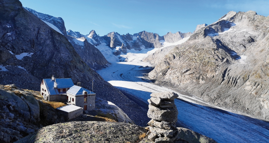
A massive-looking mountain range that rises to the west of the Muretto Pass. The route is marked since the summer of 2015.
Beste Jahreszeit
Jan
Feb
Mär
Apr
Mai
Jun
Jul
Aug
Sep
Okt
Nov
Dez
Start
Capanna Forno
Ziel
Monte del Forno
Koordinaten
46.331593, 9.710651
Details
Beschreibung
From the Forno hut, follow the white-red and later white-blue markings eastwards to the Sella dell Forno. When the trail reaches the south ridge, it continues north on the summit route. The passage through the rocks was fitted with new steel chains in 2015. The panorama from the spacious summit is great, especially the view of the north face of Monte Disgrazia.
Geheimtipp
Overnight stay at Capanna del Forno
Sicherheitshinweis
WB / The rock band is overcome by a gully by means of easy climbing (grade II). You may encounter snowfields in the summit area; a pimple is needed. Marking blue-white/red-white up to the top at about 3000 m altitude.
Ausrüstung
mountain boots, poles,
Wegbeschreibung
From the southern corner of the Forno hut, first follow the white-red-white markings to the Sella del Forno and then continue along the white-blue-white markings towards the Passo del Muretto until they reach the southern ridge of the mountain.
Here the summit route branches off, keeping to the west of the ridge - the markings easily guide you on to the summit structure. The steep passage through the rocky gully is equipped with new, solid steel chains and leads shortly to the flatter summit slopes and over them to the summit. The descent follows the same route.Translated with DeepL
Here the summit route branches off, keeping to the west of the ridge - the markings easily guide you on to the summit structure. The steep passage through the rocky gully is equipped with new, solid steel chains and leads shortly to the flatter summit slopes and over them to the summit. The descent follows the same route.Translated with DeepL
Anfahrt
Öffentliche Verkehrsmittel
Anreise Information
Verantwortlich für diesen Inhalt Bregaglia Engadin Turismo.
Dieser Inhalt wurde automatisiert übersetzt.

Diese Webseite nutzt Technologie und Inhalte der Outdooractive Plattform.
